Santa Fe's Hidden Canyon: The Story of the Municipal Watershed
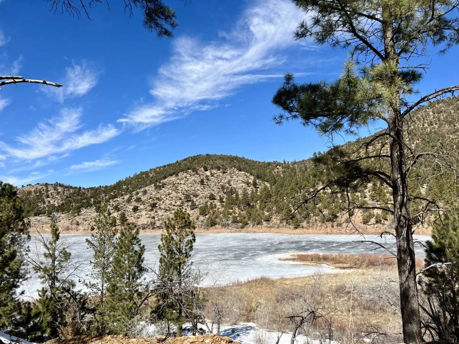
Every city has a story about where its water comes from. In Santa Fe, that story begins high in the Sangre de Cristo Mountains, in a canyon that very few people have ever seen.
Drive up Upper Canyon Road toward the Randall Davies Audubon Center and you'll eventually reach a locked gate marked Santa Fe Municipal Watershed. Beyond it lies nearly 18,000 acres of forest, streams, reservoirs, old roads, forgotten trails, and historic structures that have been largely closed to the public since 1932. For generations of Santa Fe residents, the watershed has become something of a mystery—always visible from a distance, yet almost never explored.
The irony is that this hidden canyon has quietly shaped the city's history for centuries.
Long before there was a Santa Fe, Pueblo people traveled these mountains to hunt, gather plants, and cross the Sangres toward the Pecos Valley. Spanish settlers later relied on the canyon for timber, firewood, grazing land, and water. During the Territorial period, wagons climbed into the mountains to harvest lumber, and by the late nineteenth century the cool forests had become a favorite destination for picnics and summer outings.
As Santa Fe grew, however, the canyon's greatest resource proved to be its water.
Snow falling around Lake Peak feeds the headwaters of the Santa Fe River. Those mountain streams eventually descend through Santa Fe Canyon before reaching the city. As early as the 1880s, civic leaders realized that protecting this reliable mountain water would determine Santa Fe's future.
A series of dams followed. The first, known as the Old Stone Dam, was completed in 1881. Two-Mile Reservoir followed in 1893, while McClure Dam and, later, Nichols Reservoir greatly expanded the city's storage capacity. Together these reservoirs became the backbone of Santa Fe's municipal water system.
Nature, however, had other plans.
Mountain streams carry enormous amounts of sediment during floods, and one particularly destructive flood in 1904 nearly filled the original Stone Dam reservoir with gravel, sand, and debris. It was an early reminder that engineering works must always contend with the restless geology of the southern Rockies.
By the early twentieth century, another problem had become apparent. Logging, grazing, recreation, and increasing numbers of visitors were degrading the forest and muddying the city's drinking water. In 1932, the federal government closed the upper watershed to public access in order to protect Santa Fe's water supply.
That closure remains in effect today.
Few American cities possess an entire mountain watershed that has been protected so carefully for nearly a century. While thousands of hikers enjoy nearby trails in the Santa Fe National Forest, the heart of Santa Fe Canyon has quietly remained off-limits, allowing forests, streams, wildlife, and water infrastructure to coexist with relatively little disturbance.
Yet protecting a forest presents new challenges.
For centuries, naturally occurring fires frequently swept through these mountains, clearing young trees while leaving most mature ponderosa pines standing. Beginning in the early 1900s, however, wildfires were aggressively suppressed throughout the American West. Without those regular fires, forests became increasingly dense. Small trees crowded beneath older ones, creating what foresters call "ladder fuels"—vegetation capable of carrying flames into the forest canopy.
The danger became impossible to ignore after the devastating Cerro Grande Fire near Los Alamos in 2000 and other large wildfires throughout New Mexico. A severe fire within Santa Fe's watershed could strip entire hillsides of vegetation. The following summer rains might then wash ash, sediment, and debris into reservoirs, threatening the city's drinking water for years.
Today, hikers peering into the watershed from the top of the Black Canyon Trail in Santa Fe National Forest notice extensive tree thinning. At first glance the work can seem surprising, even alarming. Yet the goal is not to remove the forest but to restore it to something resembling its historic condition—more open stands of mature ponderosa pine, healthy understories, and forests resilient enough to withstand the low-intensity fires that once shaped this landscape.
In other words, the best way to protect Santa Fe's water is no longer to leave the forest entirely alone. It is to help restore the natural processes that maintained it for thousands of years.
Old topographic maps hint at another, more mysterious chapter of the watershed's history. They show trails climbing deep into the canyon, early Forest Service roads, telephone lines linking remote ranger stations, and intriguing landmarks with names like Monument Rock. Most of these places have faded from public memory because so few people have visited them in the last ninety years.
Somewhere beyond that locked gate are the remains of ranger stations, early engineering projects, forgotten roads, and stories waiting to be rediscovered.
Perhaps that's part of the watershed's enduring fascination. It is not simply a protected forest. It is a living archive of Santa Fe itself—a place where geology, history, engineering, ecology, and conservation all meet in one remarkable canyon.
The next time you're standing on the Plaza enjoying a cool drink of water, consider where it began. That water likely started as snow falling high on the slopes beneath Lake Peak. It melted into mountain streams, passed through a canyon that has been protected for nearly a century, and traveled through one of New Mexico's most carefully managed landscapes before finally arriving in your glass.
Few visitors ever see that hidden journey.
Yet every visitor benefits from it.